
Randolph ZIP Coverage
Research located one standard postal code for Randolph proper: 02368. USPS identifies Randolph as the preferred city for that standard street-delivery area and lists the Randolph Post Office at 16 Thomas Patten Drive. ZIP+4 extensions break the delivery area into smaller address-specific segments, so a five-digit result is a starting point rather than a complete address match. No second standard ZIP serving Randolph proper was located in the research.
| Postal code | Randolph area served | Post-office route | Record-search note |
|---|---|---|---|
| 02368 | Standard Randolph street-delivery area; Randolph is the preferred city | Randolph Post Office, 16 Thomas Patten Drive, Randolph, MA 02368-9998 | Verify each complete address with USPS; delivery routes are not parcel boundaries |
The post-office facility uses 02368-9998 for its own ZIP+4. That facility extension should not be copied to another address. A postal result does not establish that a named person or organization is located at the address, and it does not replace an assessor parcel record or a Town Clerk street list.
Randolph ZIP Address Checks
USPS ZIP Code Lookup has three useful ways to test Randolph postal information. Search by address when a street number and street are known. Search by city and state when the needed result is a list of ZIP codes associated with that postal city. Search cities by ZIP when the five-digit code is already known. The address route accepts an optional company line and apartment or suite detail, but the full street and city-state information do the main work.
| Search by address | Street address, city, and state are the core inputs; company and apartment or suite fields are optional. |
|---|---|
| Search by city and state | Enter the required city and state to review ZIP codes associated with that postal city. |
| Cities by ZIP | Enter the required five-digit ZIP to see USPS city naming information. |
| ZIP+4 result | An address-specific delivery segment, not a stand-alone town or person lookup. |
The USPS search screen provides the address-verification route. Use the exact address route before carrying a ZIP result into a property, municipal, or historical search.
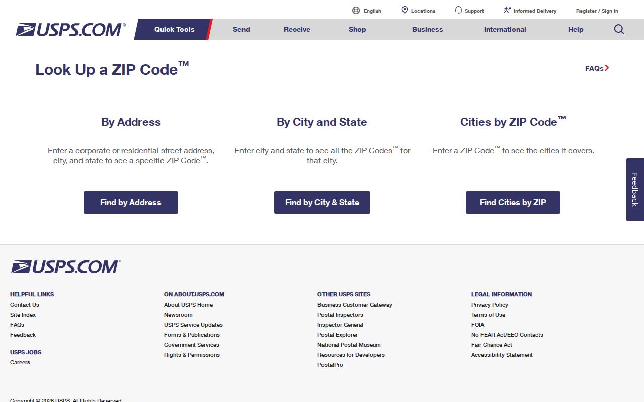
USPS warns that a ZIP result does not confirm a person or company at an address. That limit makes the full address, record type, and date important when comparing sources.
Randolph ZIP Geography and Town Lines
Postal delivery geography and Randolph's legal geography do not use the same keys. Randolph was incorporated in 1793 from Braintree and adopted a city form in 2010 while retaining the Town of Randolph name in official use. It is divided into 12 precincts for electoral mapping. Surrounding municipalities include Quincy, Braintree, Milton, Canton, Stoughton, Holbrook, and Avon. Those municipal and precinct boundaries are not a map of USPS carrier routes.
Postal ZIP areas can cross municipal lines, and a mailing address can use a preferred post-office city different from the municipality that keeps the parcel or record. The research did not locate an official parcel-level map showing every 02368 crossing, so no precise crossing should be assumed. Use the Town Planning, Engineering, or Assessors offices for the legal address and parcel interpretation, then use USPS for delivery validation.
Note: A ZIP can narrow a search area, but it cannot decide which court, town office, precinct, or property record has custody.
Find Randolph Residents in ZIP 02368
A postal search supports a staged search, not a ZIP-wide people list. Randolph's assessor static page did not expose a ZIP search field, MapGeo's text landing page did not expose one either, and no official ZIP filter was located for the local voter file. The Town Clerk may receive a local request scoped by municipality, precinct, or street. USPS verifies a particular mailing address. Those documented limits matter more than a guessed filter.
- Run the full known address through USPS and preserve the returned five-digit ZIP and ZIP+4 only for that address.
- Use the city, street, parcel, or owner information in the Randolph assessor database when the question is about a property record.
- Request an appropriate local voter or street-list record from the Town Clerk when the question is civic residence, observing protected-voter limits.
- Check Norfolk Registry material by owner, town, document date, legal description, plan, or book and page for a title question.
- Move to the Randolph street directory only when a ZIP has been narrowed to an actual street and number.
Do not claim a ZIP-wide answer from an assessor or voter portal unless its live search interface actually offers that field. A local request can be narrower and more reliable than a broad filter that the custodian never published.
Randolph ZIP Address Keys
One address may have several valid forms because different record keepers use it for different tasks. The assessor and GIS use the situs address where a parcel or building stands. A tax mailing address is where an owner receives correspondence and may be outside Randolph. Norfolk deeds rely on a legal description, plan, lot, boundaries, or title reference. USPS uses a delivery address and route. A historical town directory may record a street form that has changed or an address that needs a time-specific interpretation.
- ZIP code
- A postal sorting label for a delivery area, not a legal boundary or a record of every person in that area.
- ZIP+4
- A four-digit extension that narrows delivery to a smaller, address-specific segment.
- PO-box ZIP
- A code assigned for post-office-box service. No separate Randolph PO-box-only ZIP was located.
- Unique ZIP
- A ZIP used for one institution or organization. No separate Randolph unique ZIP was located.
- Carrier route
- A USPS delivery sequence used for mail distribution, distinct from town precincts and parcel lines.
Reverse directories and local city directories can answer historical address-to-occupant questions for the year of a volume. They do not turn a five-digit postal code into a current household roster.
Randolph ZIP and Census ZCTA
Census ZIP Code Tabulation Areas, known as ZCTAs, are generalized statistical geography based on Census blocks. A ZCTA is not a USPS delivery route or a parcel boundary. Census data tools can filter for a five-digit ZIP geography when a statistical question is appropriate, but the output should be labeled as ZCTA information rather than a legal Randolph boundary. This distinction prevents a population table from being mistaken for a postal or resident record.
Randolph's 2020 Census population was 34,984, and the Census Bureau's July 1, 2025 estimate was 34,948. Those totals offer community context only. They do not identify a person, establish an address, or show who receives mail on a carrier route. The municipal statistical label also changed after the 2019 city-form shift, so researchers comparing Census years should preserve the source's geographic label.
Randolph ZIP Record Request Routes
When a ZIP check points to a Randolph address but the needed answer is held in a local record, use the keeper that matches the question. Randolph Town Clerk records include annual street-list books, voter registration and election records, local vital events, marriage intentions, burial permits, and town documents. The Randolph Assessors' Office holds the property-tax trail, while Randolph Inspectional Services keeps address-keyed permits and code material. Norfolk Registry of Deeds holds the title and plan trail, and the court clerks keep court files.
Each route has a different access channel. The Randolph Action Center links the online assessment database, MapGeo, permit center, and town payment services. Inspection requests are scheduled by phone, according to Randolph Inspectional Services. A Randolph public-records request can be made to the Town Clerk or relevant Records Access Officer when no online index exists. Under M.G.L. c. 66, § 10, the normal response deadline is 10 business days. Ordinary black-and-white copies are capped at five cents per page, and labor fees generally begin after the first four hours, capped at $25 per hour.
A postal code belongs in a request only when it helps identify the Randolph address. Add the street, parcel or map reference, date range, and specific record series. A clear Randolph request is more likely to reach the correct office than a request that asks for every person connected to a postal area.
Randolph ZIP Post Office Details
USPS lists the Randolph Post Office at 16 Thomas Patten Drive, Randolph, MA 02368-9998, with telephone 781-963-0386. The location is a useful official reference for postal service details. It is not a record custodian for town voter lists, deeds, assessment cards, or historical directory holdings.
The official USPS location view confirms the facility information and provides a distinct route from the ZIP lookup form when a postal-service question concerns the Randolph office itself.
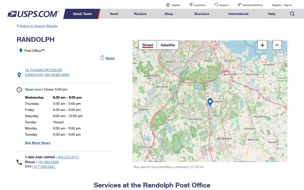
For a parcel or owner question, return to the assessor, MapGeo, and Norfolk Registry rather than treating post-office details as property information.
Randolph ZIP Search Limits
The postal reference has a clear boundary: it verifies delivery geography and address formatting, not residency. It cannot identify renters, household members, utility customers, delivery recipients, or protected addresses. Local voter information also omits confidential voters and other protected fields. The state does not publish a general public statewide voter file, and a public local list remains subject to Massachusetts confidentiality rules.
When the available record does not answer the question, send a narrow request to the office that keeps the specific series. Massachusetts Public Records Law requests can identify a date range and format, but the custodian need not create a new list or disclose exempt information.